Surface velocities of a Greenland outlet glacier
from high-resolution visible satellite imagery
Abstract: A multidisciplinary team of researchers reports the results of a study of the feasibility of utilizing high-resolution Declassified Intelligence Satellite Photographs (DISP) to derive surface speeds of fast-moving Greenland outlet glaciers from tracking surface features on sequential DISP images. The images provide coverage of the entire Greenland Ice Sheet for most of the 1960s and their value as a resource for establishing a baseline for assessing ongoing and future changes in the ice sheet is demonstrated.
Application of DISP: KANGERDLUGSSUAQ GLACIER
 |
 |
|
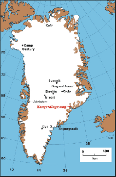
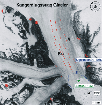
| Location map | DISP Image of Kangerdlugssuaq Glacier, east Greenland |
 |
 |
|
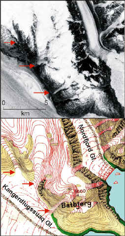
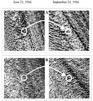
| Glacier changes 1933 - 1966 | Magnified view of the two features labeled A and B in the DISP Image on the June 23 and September 24, 1966 images. |
Reference
Csatho, B. M., J. F. Bolzan, C. J. van der Veen, A. F. Schenk, D-C. Lee, "Surface Velocities of a greenland outlet glacier from high-resolution visible satellite imagery," Polar Geography, 1999,23, No.1, pp.71-82. (pdf)